Founded in 2017, Zulu Waterways is a global resource for cruising sailors and professional mariners. Explore over 100,000 anchorages, marinas, fuel docks, and more—built through contributions from the community and verified by the Zulu team. - For sailors who go places
Explore the Zulu Waterways map below:
Download the app or visit the websit: Learn from those who sailed before you.
Explore the Map iOS App Android AppDiscover thousands of global POIs informed by firsthand user input and backed by Zulu verification.
From the Pacific to the Med, Zulu connects you to reliable navigation data, contributed by fellow cruisers.
Access national hydrographic charts online and use Navionics or satellite imagery offline.
Download high-resolution satellite maps for remote zones—vital where charts fail.
Quick tutorials on markers, charts, and offline downloads to help you master the platform.

Questions or feedback? Reach out anytime.
Since 2017, sailors, professional mariners, and small craft boaters have contributed over 25,000 markers and 1,500 comments to the guide. This incredible wealth of shared knowledge supports everyone sailing in their wake.
We are immensely grateful for each contribution—your insights form the very foundation of the Zulu platform.
The Zulu team regularly researches regional boating guides, open datasets, and community input to ensure accuracy and completeness.
We draw from sources such as OpenSeaMap and cross-check with hydrographic data and published guides. To date, our team has manually added nearly 40,000 verified points of interest to the Zulu database.
Zulu actively collaborates with trusted content creators, including guidebook authors and local sailing clubs.
Examples include the Fremantle Sailing Club’s WA Cruising Guide, Jack and Jude Binder’s anchorage series, and Terry’s Topics for Southeast Asia. These contributions are credited within the markers and help enrich the community map.
You can contribute directly through the website or app. Log in with your email, Google, Apple, or Facebook account, and use the target button to add a new marker.
Include useful facts, photos, and any personal experience—it makes a big difference. You can even add markers offline via the app, which will sync once you’re back online.
Have a full dataset to share? Email contact@zuluwaterways.com. We support most formats and will work with you to bring your data to life on the Zulu map.
All content is licensed under CC BY-NC-SA 4.0, allowing free use and adaptation for non-commercial purposes with proper attribution.
Commercial use requires prior written permission. The Australian Hydrographic Office retains all rights to chart content, which is excluded from this license.
Zulu Waterways spans the globe—from the Pacific Islands to the Mediterranean—connecting sailors with reliable anchorage information, navigation advice and even where to find a hot shower. The platform began in Australia in 2017, and while the coverage in the Oceania region is strongest, whether you are crossing the Coral Sea or cruising the Ionian coast you will find useful information to help you sail safe and see more. Don't believe me...give it a go and hit the explore button to go to a random marker somewhere on the map.
While we always consider Zulu primarily a Cruising Guide, we've added a number of chart layers to assist in making decisions when anchoring or entering a new area. The online version includes several hydrographic chart layers, all viewable for free:
To access these charts on the website or in the online mode of the app:
The Map Layer menu also includes the Open Sea Map (OSM) layer. OSM is an open-source guide that includes navigation aids and markers. Enabling this layer overlays OSM data on your map for extra visibility.
Zulu Offshore includes a Navionics chart layer for offline use. If you have an active Navionics subscription, you can link your account to Zulu and download charts for offline access. Here's how:
Once linked, you'll be able to download charts by zooming in on the region you want. After a few seconds, charts for that area will automatically begin downloading to your device.
As Zulu was first developed by Australian sailors near the Great Barrier Reef, we knew from the outset that satellite imagery would be essential. From navigating reefs to finding anchorages in poorly charted areas, satellite images provide context where traditional charts may fall short.
Zulu includes a variety of online satellite sources that require an internet connection:
To access these in-app or on the website:
Being able to toggle between different imagery sources helps identify reefs, water depth, shoreline composition, and man-made structures.
Both Zulu Offshore and Zulu Waterways apps support offline downloads. For best results, we recommend using Zulu Offshore, which was designed with offline capability in mind.
To download imagery for offline use:
TIP: For higher quality MapBox downloads, go to Main Menu ? More ? Preferences and enable "High Resolution Downloads". This upgrades standard and hybrid options to HD.
Each download uses tokens. We give all users 100 tokens per month, which resets monthly. Standard Satellite and Hybrid use 1 token. HD Satellite, or high-res versions of the other two, use 2 tokens each.
If you run out, you can:
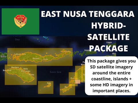
In response to frequent requests, we've created regional Map Packs - precompiled satellite tiles bundled for entire coastlines or popular zones.
These require payment (via Stripe) and can be found at zuluwaterways.com/shop. Why paid? We incur monthly costs from satellite providers and must cover them to keep the service going.
Once purchased:
The imagery is then stored on your device permanently. No expiration, no subscription, and usable across all your devices (activate on each one).
Check out the Map Shop to browse available packs and enhance your offline coverage with reliable satellite detail.
Zulu has never needed to advertise, thanks to the incredible support of our community who help spread the word. Even so, we've been fortunate to have magazines and online platforms feature articles about us, further extending our reach
MySailing profiles Zulu Waterways as a leading Australian cruising guide built from firsthand data and community contributions.
Read more →A deeper dive into Zulu’s latest tools, including offline satellite charts and a growing POI database for remote cruisers.
Read more →Legendary cruisers Jack and Jude collaborate with Zulu to offer curated anchorage packs and insightful cruising content.
Read more →Yachting Monthly lists Zulu Waterways among top-rated apps for offshore sailors and coastal adventurers.
Read more →